The Art of Perambulation
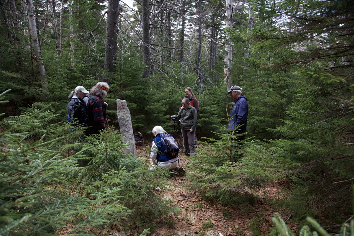
Recently, I found myself involved in this particular NH tradition, with a group of representatives clustering around a carved stone in the middle of the woods in NH... This isn't some sort of Druidic or Pagan ritual...
(This was originally a post on Twitter that I've updated and recreated here, since this is more of a long-form article than something doled out in 280-character chunks)
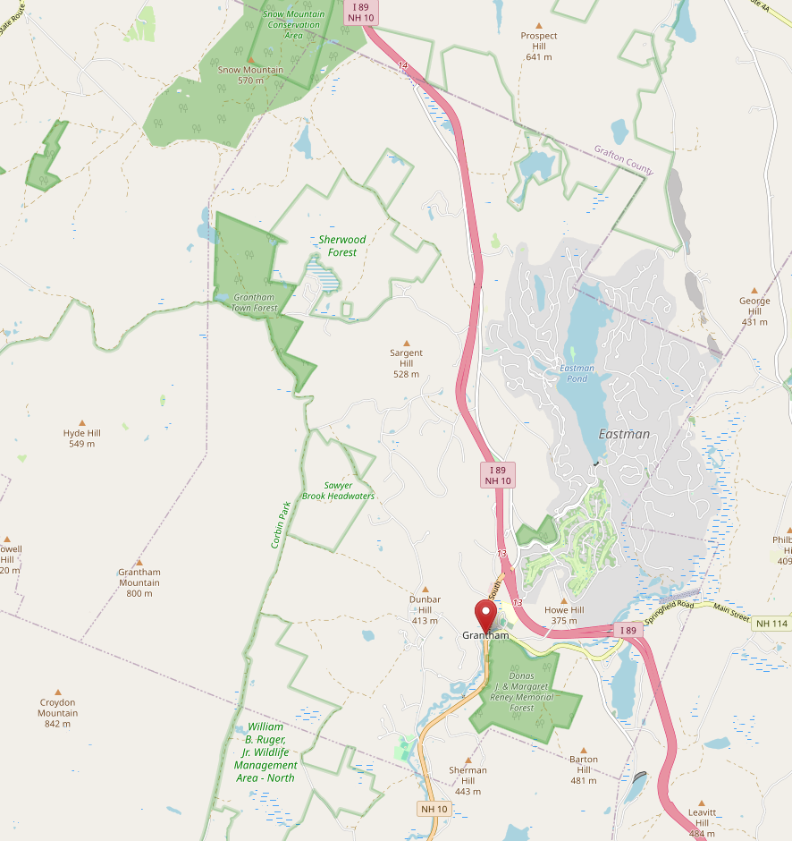
Recently, I found myself involved in this particular NH tradition, with a group of representatives clustering around a carved stone in the middle of the woods in NH. This isn't some sort of Druidic or Pagan ritual, but Perambulation, the act of walking around a surveyed parcel of land to establish borders. (We're all standing around the Plainfield-Croydon-Grantham tri-point, which is particularly remote).
The origins of Perambulation
The origins of come from old English practice of "Beating the bounds" in which parish boundaries were walked. But it's still practiced in several respects in some New England States, and it's still a requirement in New Hampshire and Massachusetts. Here's the relevant bit of New Hampshire RSA 51:
51:2 PERAMBULATION of Town Lines. –The lines between the towns in this state shall be perambulated, and the marks and bounds renewed, once in every 7 years forever, by the selectmen of the towns, or by such persons as they shall in writing appoint for that purpose.
Many Selectboards either don't keep current in their perambulation, or, most frequently, designate someone other than the Selectboard to actually perambulate. Recreational departments and Conservation Commission, usually. Or in some towns, they just hire a surveyor every few years. It's a soft requirement, in that there's no defined penalty for not perambulating, and only a $50 penalty for not providing sufficient notice or attending a Perambulation called by a neighbor town. So actual compliance with this RSA is uneven at best. In the last full survey of towns by UNH, only 15 of 110 towns surveyed in 2010 had comprehensively walked their lines in the required 7 years before the survey, and a quick check of town websites indicates this level of compliance is still the case.
My town of Grantham is one town in the region that actually attempts to stay current with our perambulations, with a reasonably good track record. Our neighbors Plainfield to the West, and Enfield to the North are two of the other towns that make a concerted effort at maintaining currency as well. But according to the NHMunicipal Zoning Atlas, there are 624 distinct town lines between NH's 221 towns and 13 cities, and range in length from literally yards, to several miles.
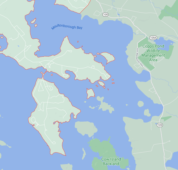
They also range from simple line segments (straight line between two markers), to elaborate serpentine paths. For the former, Alton, NH and Moultonborough, NH look like they are nominally not "adjacent" except at a corner, but due to surveying issues, they have a common border that's a few yards long, entirely in Lake Winnipesaukee. For the latter, the Moultonborough-Tuftonboro border snakes in and around the many islands in Moultonborough Bay:
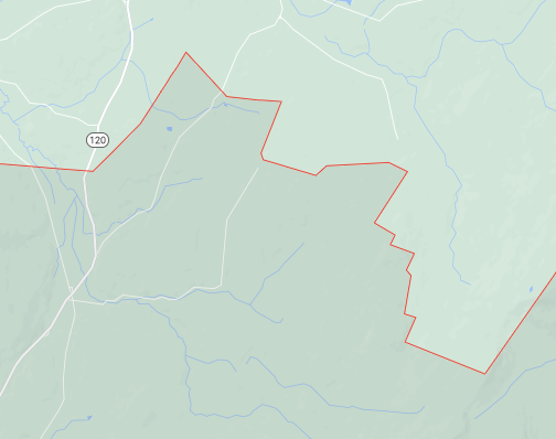
While that was due to islands, sometimes land borders aren't much easier. The Cornish-Plainfield boundary, for example, involves more than 30 individual boundary markers snaking through the woods, as part of boundary adjustments involved as that part of Meriden village seceded from Grantham and joined Plainfield. You can see the resulting border followed individual plots:
Depending on the particular border in question, a Perambulation can be anything between "trivial" and "major expedition", and can often involve high peaks, vertical cliffs, private property access, wild animals, swamps, rivers, and all sorts of other physical challenges (as an aside, I'm curious to know which of NH's perambulations is the easiest, and which the hardest; I'm sure some of the ones in the White Mountains are extremely difficult).
It's also a scheduling challenge, since two or more towns need to agree, and often need to make arrangements with private land owners to get the necessary access. The Selectboard needs to be available, willing, and able to Perambulate (one of our town's perambulations requires miles of hiking with 1000' climbs), or necessary written approval of replacement perambulators arranged (this is how I got into Perambulation, since I am one of the officially appointed Perambulators for the Town of Grantham).
So, every seven years, a bunch of people need to coordinate schedules, and go hunt, often in the deep overgrown woods for obscure markers after they've suffered 7 years of frost heaving and weather.
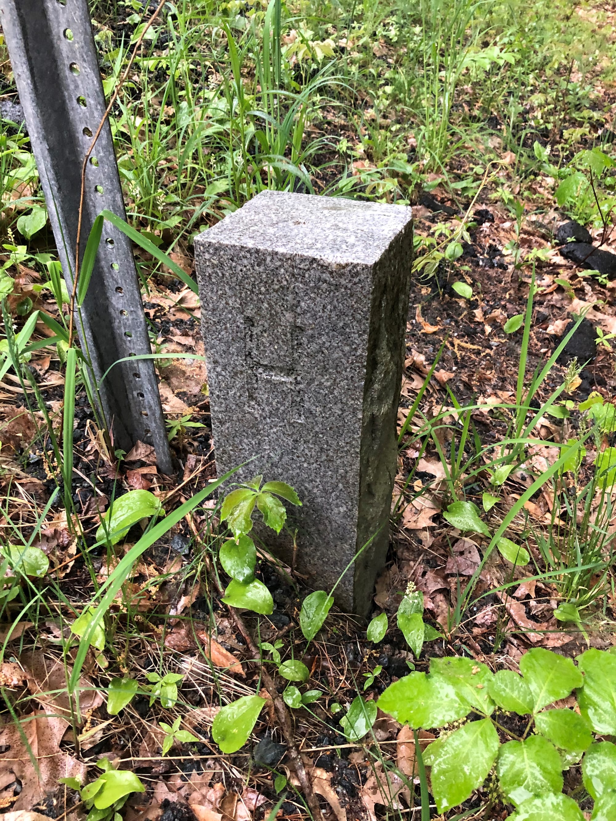
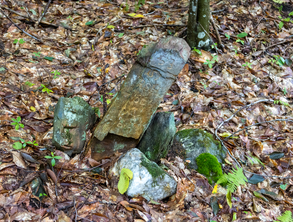
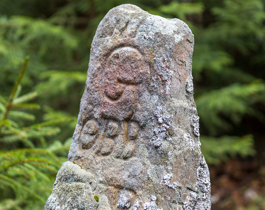
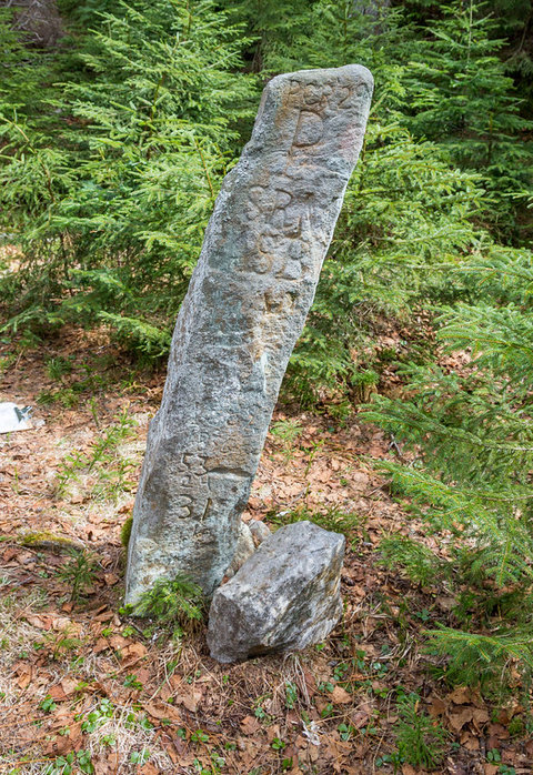
In any case, most of the town lines are defined not by latitude/longitude or other GIS coordinates, but by actual border monuments. Often these are actual monument stones, but range from "piles of rocks", to "carvings on cliff faces", to "big pile of rocks", to "professionally-masoned stone markers". A good example of a marker is the image above. A good example of the last of these is one of the Lebanon-Hanover markers a short distance from my office:
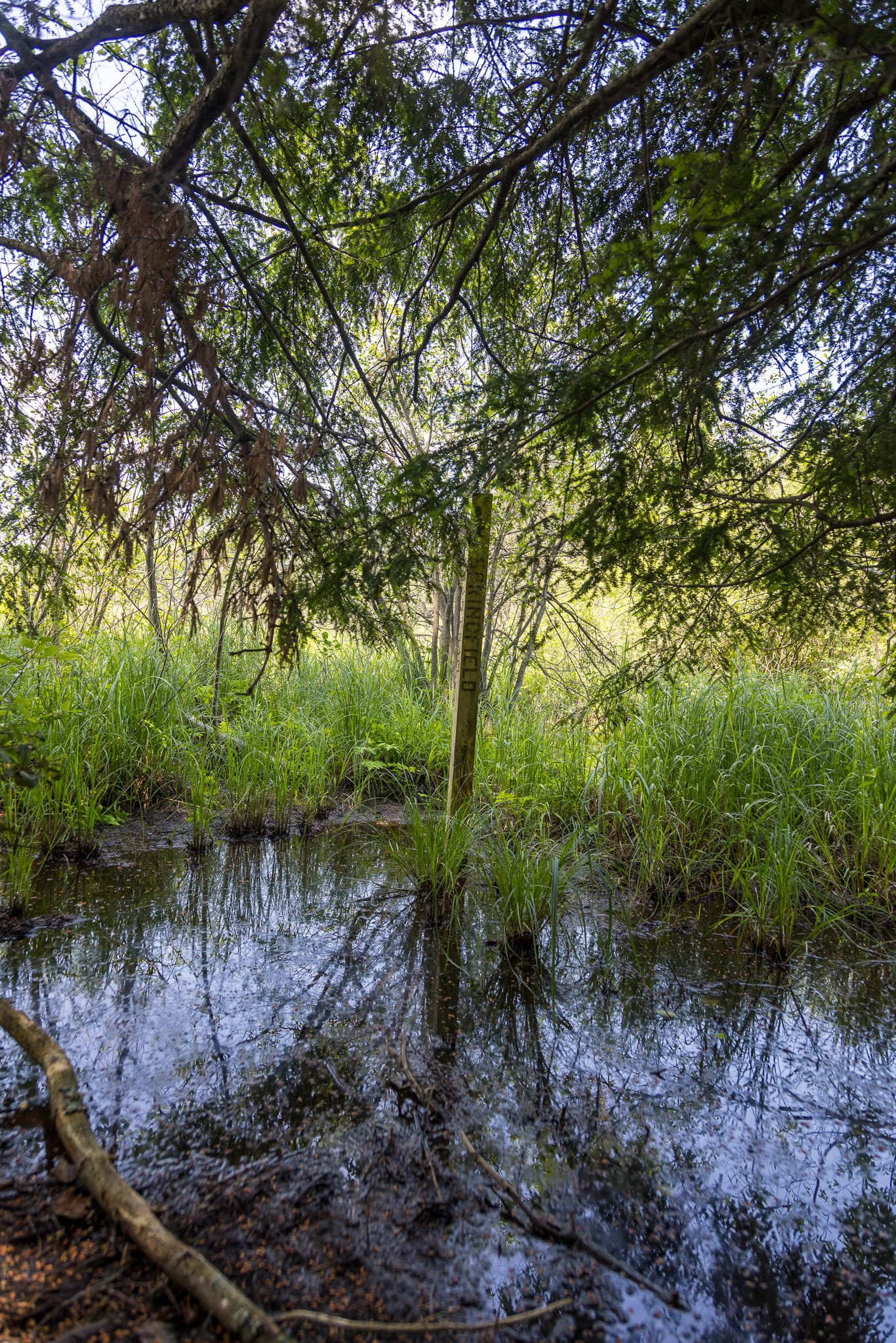
More recently, I visited Boundary Marker 11 on the Grantham-Springfield border, which is a serious contender for "least-desirable location in both towns", being located in the middle of a swamp on the border:
Why Perambulate?
So, that brings up the question of "Why do we even do Perambulation?" A frequent variation of this question is "Can't you just use GPS and Google Maps?!" This isn't just a layperson's question, but one that regularly comes up before the NH Legislature (especially after Maine abolished the requirement in the early '00s), most recently in 2017. And having fully perambulated the entire border of Grantham, NH, part of me asks the same question as well.
I'm actually in favor of retaining the requirement, perhaps with modifications. And not just because I actually enjoy a good trounce through the woods. ("It's like geocaching... without the caches"), so I figure I should outline my modest case in favor of Perambulation.
To make this a bit more relatable, I'm going to focus on my own town of Grantham, to illustrate some of the challenges here. To start with, you need to answer a basic question, and that is "what is the actual border of Grantham, NH?" Like almost every town and city in NH, the original borders of Grantham were Grantham's original borders were drawn as part of a charter in 1761 by Governor Wentworth that divided most of the state into various towns, most of them deliminated as either simple quadrilaterals, or using existing bodies of water in place of lines (as an aside, you can read an excellent history of neighboring Enfield's lines done in 2010 by Enfield Perambulator Kurt Gotthardt).
The original settlement for Grantham failed, borders were used in a second charter settlement in 1767, with approximately rectangular borders. But few borders in NH have remain unchanged. But over the intervening 250+ years, more than a few changes have happened to Grantham, with land exchanges with adjacent towns.
Back when the towns were designed, the borders were conceptually simple, each town being decided by markers at the corners (usually actual stone markers), and straight lines between them. But as the town boundaries involved, each property transfer (needing new, intermediate boundary markers) caused revisions, and then various surveying errors and deed discrepancies between as-built and original survey coordinates also cause some of the boundaries to be more complicated.
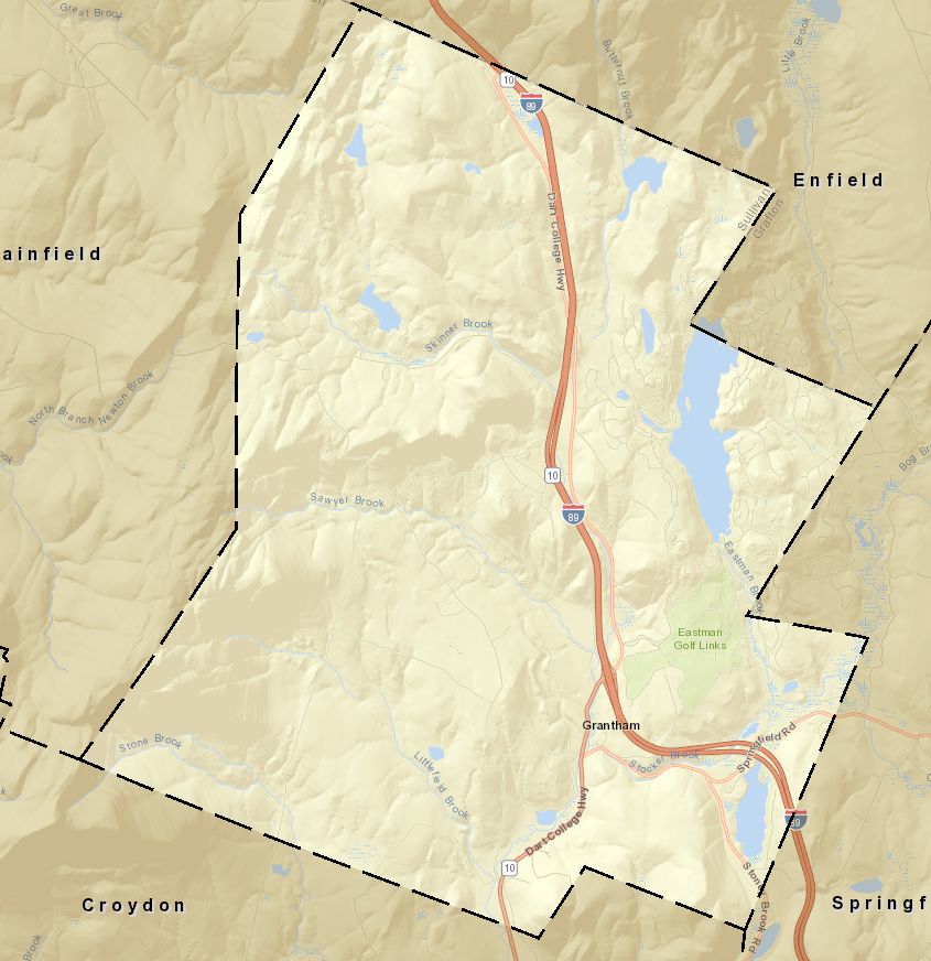
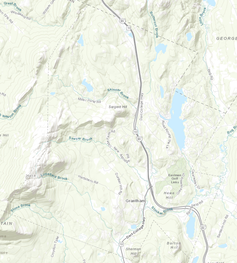
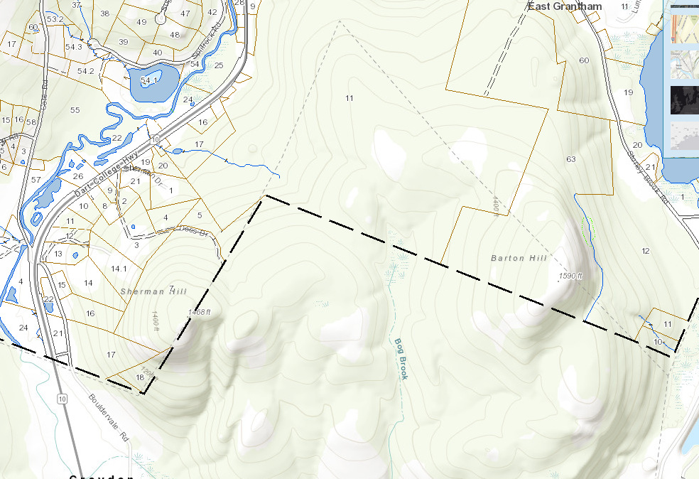
The resulting town of Grantham is a bit unusually shaped, but is mostly rectangular and has defined borders with Croydon, Enfield, Springfield, and Plainfield. Due to the presence of a substantial mountain (Grantham Mountain, formerly known as Blue Mountain) in the middle of town, several early residents on the western part of town couldn't easily get to Town Meeting. So in 1856, these farms basically seceded and joined as part of Meriden, a village in neighboring Plainfield (and indirectly leading to the very convoluted Plainfield-Cornish border). Similar adjustments over time have seen border shifts with the Grantham-Croydon and Grantham-Springfield boundaries as well.
The resulting town of Grantham is a bit unusually shaped, but is mostly rectangular and has defined borders with Croydon, Enfield, Springfield, and Plainfield. Here's the current map of boundary markers, current as of the last perambulation (of the Grantham-Enfield border in 2024). The actual boundary consists of 34 boundary markers (most are either carved granite markers or wooden posts, but some are simple rock piles or engravings on cliffs), plus another 6 supplemental markers:
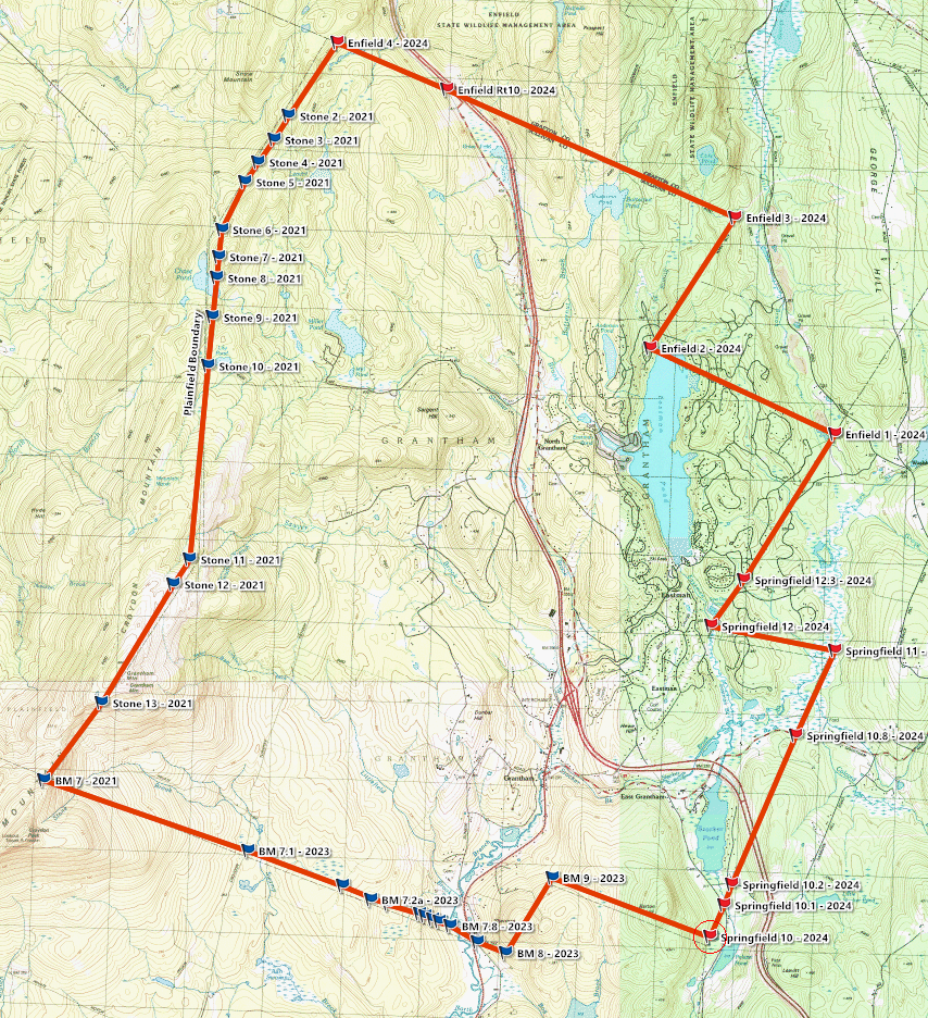
Indeed, you can see how the Croydon-Grantham boundary includes BM7.1 through BM7.8, a result of a minor border dispute and re-survey recognizing that the as-built effective and recognized boundary line actually lies a bit north of the straight line between BM7 and BM8.
Here, there's a short digression into how properties and towns are actually surveyed, and here in New England that usually involves "Metes and Bounds" (or as called in RSA 52:2, "Marks and Bounds"). "Metes" are boundaries defined by measurements of lines between well-defined landmarks, either something like "straight line between boundary stone 1 and 2", "arc of radius 100ft from marker to old tree", or (more recently) "proceeding at an angle of 241 degrees magnetic", or "at 171 degrees from the pin at 43° 29' 20" N, 72° 12' 58" W". "Bounds" are even more general, like "extending along the Sugar River", "along existing stone wall", "along the public right of way", or "extended to the corner of the building".
You can start to see the problem here: a lot of these measurements are relative to existing, known landmarks, and aren't (except for very recent surveys) even usually coordinates. Remember, much of this was defined back in the 1700s. That, and you can see that for the most part, the town border is one of the "bounds", it's defined in terms of itself! The town border is defined by the boundary markers! And the surveying principle of “rules of construction” comes into play as well, which means that if the first surveyors, with the tools and information at the time, put a stake in the ground and called it the corner, and landowners recognized that stake, then it became the actual corner. And these results often mean that the actual boundary markers may vary from the Wentworth charter, sometimes by as much as a quarter mile! Not helping is that, up until the late 20th century, most anyone could hang out a shingle and declare themselves a "surveyor" (and in the post-Civil War westward resettlement, many of NH's qualified surveyors moved west). A good side read is this Valley News piece on evolving standards of surveying in NH, including the antics of Vernon Hood, who until 1971 would bang out dubious deeds on his typewriter for $10.
Looking back at that Grantham map, you can see a few of the issues. The map is plotted over USGS contour maps, and you can see a lot of disagreement here. Most of the USGS survey data dates from 1927, and they didn't usually do a precision survey at the time, they just copied information from existing maps. Aside from a 1996 effort to resurvey some town markers (these are marked with small rectangles on the current USGS tops), these often have errors of at least 100', and these errors have subsequently propagated through successive maps. It usually doesn't matter what map source you are using (OpenStreetMap, Google Maps, Apple Maps, NH GRANIT, or AxisGIS, to list some of the better ones).
For example, the Southwest corner of town sits about 250' SW of what the current USGS maps show as the towns's corner. The NE corner likes a similar distance off to the East. And Springfield Marker 12 is a good 500' off where shown on the USGS map.
Let's compare various mapping sources available online, like those recommended by those proposing abolishment of Perambulation, and see how they do with Grantham's borders. To start, here's a nice plot from AxisGIS, who built this from the Town's tax maps, and it's actually one of the most accurate, and generally closely matches both the perambulated markers. It's actually pretty good, about the only clear discrepancies comparing with the GPS data collected during the Permabulations (where the GPS is allowed to integrate for at least 5 minutes, reporting a horizontal error under 5ft) were in the NW corner of town, and there the discrepancies aren't much more than GPS error (10–15 ft).
But if we look at the popular Google Maps, you can see a handful of differences here, some of them major. The SE border of Grantham is almost completely different! If you zoom in on any of the borders, you'll find all sorts of ~10-50' discrepancies, too. But if you were to try to use that Google Maps data and your trusty GPS to figure out if you were in SE Grantham or NE Croydon... good luck (luckily, most of that is one parcel).
UNH's Granit View, which is the official GIS repository for the State of NH, has yet another view of the town. This one is pretty close to the AxisGIS one, but if you were to zoom in, there's still a lot of ~50' discrepancies:
Another good source is OpenStreetMap. Nominally inheriting most of the data from USGS, it mostly shares the same discrepancies, but it at least has the advantage that there is a clear and well-defined process to update the data:
Similarly, here's another widely-used GIS service, ESRI. Their map is more accurate than the Google one, but still has a lot of major discrepancies:
Due to the way the town tax maps are browsable (here's Grantham's official maps), it's pretty easy to compare the AxisGIS data (generally good) to the ESRI data, as well as view some of the weirder border anomalies.
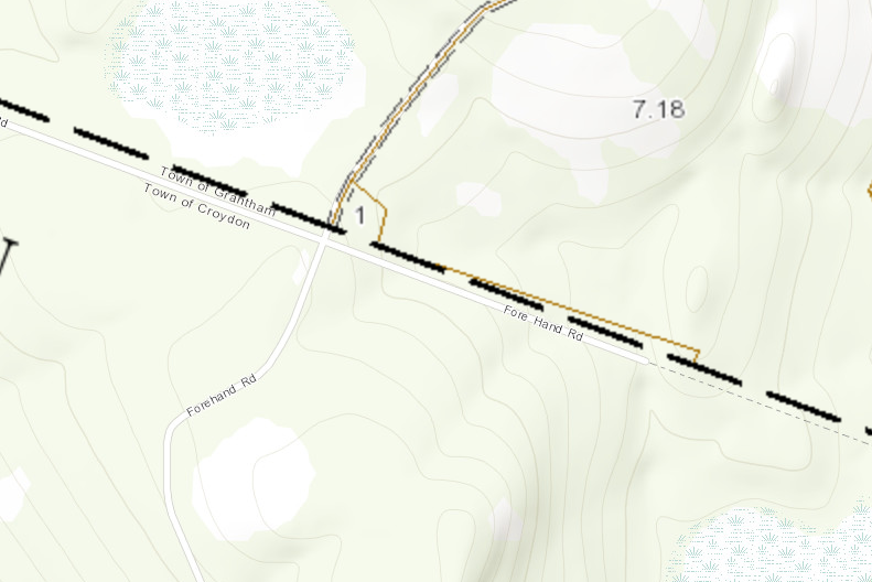
A good example of the as-practiced border not matching the original charter is Forehand Road on the Grantham/Croydon border. Way back in the day, this was a fairly major east-west road defined by two markers, Stone 7 and Stone 8. But you can see, the line and the property wander a bit off of that, and at some point (I'd have to review individual deeds to determine a date), the towns resurveyed and accepted a new as-built arced line (with boundary markers 7.1 through 7.8). But even then, there was a "gore", where later surveying found that the land borders didn't quite match up, and they adjusted lot maps and created a new lot to fill in the difference.
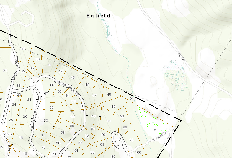
Another good example is Springfield Marker 1, which is also the tri-point of Grantham, Springfield, and Enfield. The ESRI maps shows a lot of the complicated history. ESRI, AxisGIS, the actual stone, and Google data all have different locations for this town corner, and there's a large wedge-shaped lot (lot 94) along the border. Depending on which source you look at, there are four different borders shown here:
Now look at bit west at Springfield Marker 12, and you can see that a "few feet here and there" can make a huge difference with small lots. Here the ESRI and AxisGIS data disagree by several lots! I guarantee you that the owners of these ten-ish lots care rather a lot about whether that corner marker is at which one of the locations shown by the two different maps, since it makes the different between living in Springfield and Grantham:
And to me, the real fun one is Boundary Marker 9 between Grantham and Croydon. Various sources disagree about this location by almost half a mile! (I know this marker well, the AxisGIS data (dark dash) has it right). But hey, what's ~250 acres between friends...
So, with all that in mind, the reasons I support perambulation:
- Without a lot more survey and cleanup, there are still enough discrepancies between GIS and on-the-ground actual monuments. Survey and fix those markers first.
- Several industries (timber logging being the big one) actually rely on those stone markers in preference to GPS/GIS.
- Those markers do occasionally disappear or need to be reset (Grantham's Plainfield boundary markers were heavily damaged by a 1953 forest fire, and one of them hasn't been found since)
- Maintaining town borders is not only a vital function of a town, but it's also a fine tradition (it's one of the few 'friendly' functions that involves town leadership meeting)
- Modern day dispute with boundaries are still not uncommon.
- GPS, phones, and other tools are useful, but sometimes it is really great to have a visible, clear marker.
Highlights of the Grantham Perambulation
As the town of Grantham Perambulator, while a full Perambulation is quite difficult, it's not without it's attractions, and challenges. So I figured I'd give some highlights from the last set of Perambulations in 2021–2024 (yes, it took us a bit over 3 years to do the whole set).
Grantham-Plainfield Border
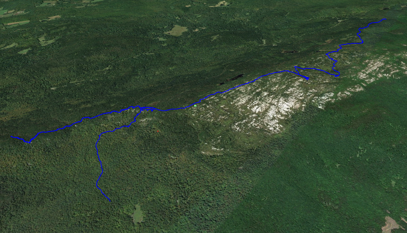
I'll start with the Grantham-Plainfield Border. While I suspect there may be some even more challenging perambulations in the NH's White Mountains, Grantham's Plainfield boundary is particularly vexing. Most of it is along a sharp cliff line atop Grantham Mountain, aka the "Gray Ledges". To start with, it's on private property of the most private variety:
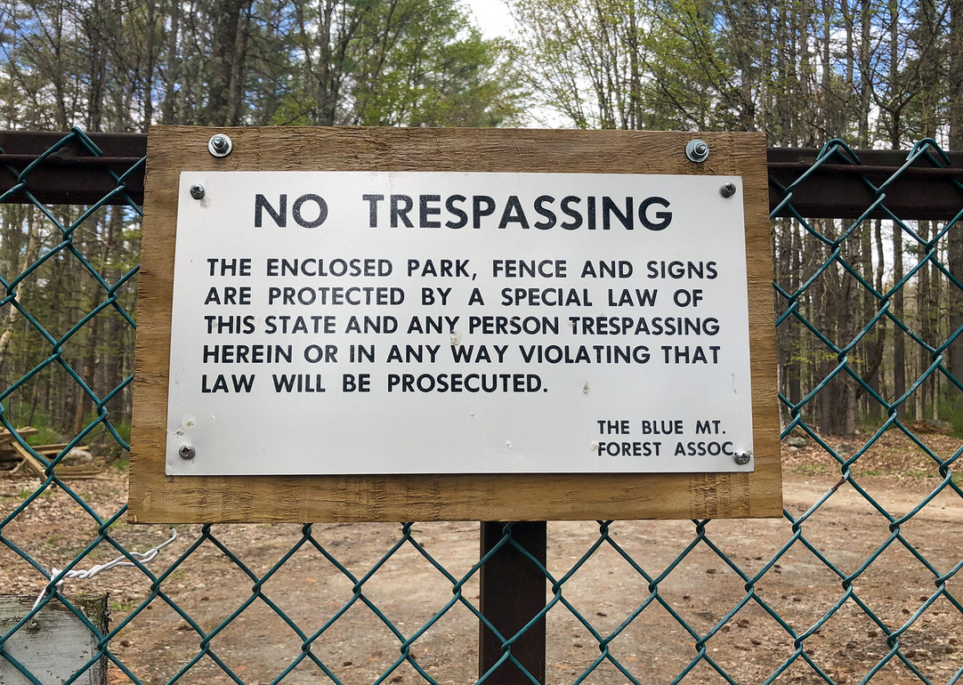
Yes, most of the border is inside NH's exclusive (and reclusive) Corbin Park (for a good overview, I recommend Austin Longpré's History of Corbin Park). Long the subject of local lore, and the occasional feral wild boar escaping the park, the park is also well-known for refusing almost all external requests for access (particularly, they get a lot of requests to climb Croydon Peak, which is the Sullivan County high point). Perambulation is one of the very few reasons they'll let uninvited non-members into the park (and to be fair to the park, most people don't want strangers galavanting around their backyard, and they were actually extremely accommodating once we gave them an official Town request). Both the Croydon-Grantham and Grantham-Plainfield boundaries have substantial length in the park, and the hike to that ridgeline involved off-trail bushwacking, a lot of climbing, and more than a little bit of dead reckoning, and much mud.

So this definitely isn't something that your average NH selectboard member (at least for my town) is going to be doing, and more than a little effort was expended on finding suitable Perambulators for each town, and coordinating schedules between the Park and the Perambulators. But in the end, it also gave us access to one of NH's most exclusive hikes (no photos; a condition of our access was that we only published photos of official markers).
Grantham-Enfield Perambulation
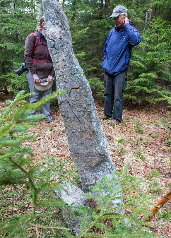
Both the Grantham-Plainfield and Grantham-Enfield perambulations visited this stone marker, which marks the tri-point of Grantham-Plainfield-Enfield. Here, you can see back in the days before GPS, the primary way the Perambulators "documented" their work was by chiseling initials and dates into the marker. These turn out to be quite valuable when looking for these markers, so you can tell the monuments from other random rock piles:
Grantham-Croydon Perambulation
The Grantham-Croydon Perambulation took us to the Croydon-Grantham-Plainfield marker, which is several hundred feet off of the summit of Croydon Mountain. It's one of the oldest markers, with all sorts of engravings:
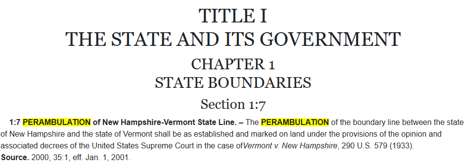
Addendum: The VT-NH State Line
There's also the interesting case of the VT/NH border. While most States sharing a border historically use the centerline of the river, but the border between VT and NH is well-defined by treaty as "west bank of the Connecticut River". This definition caused a lot of land disputes depending on water level.
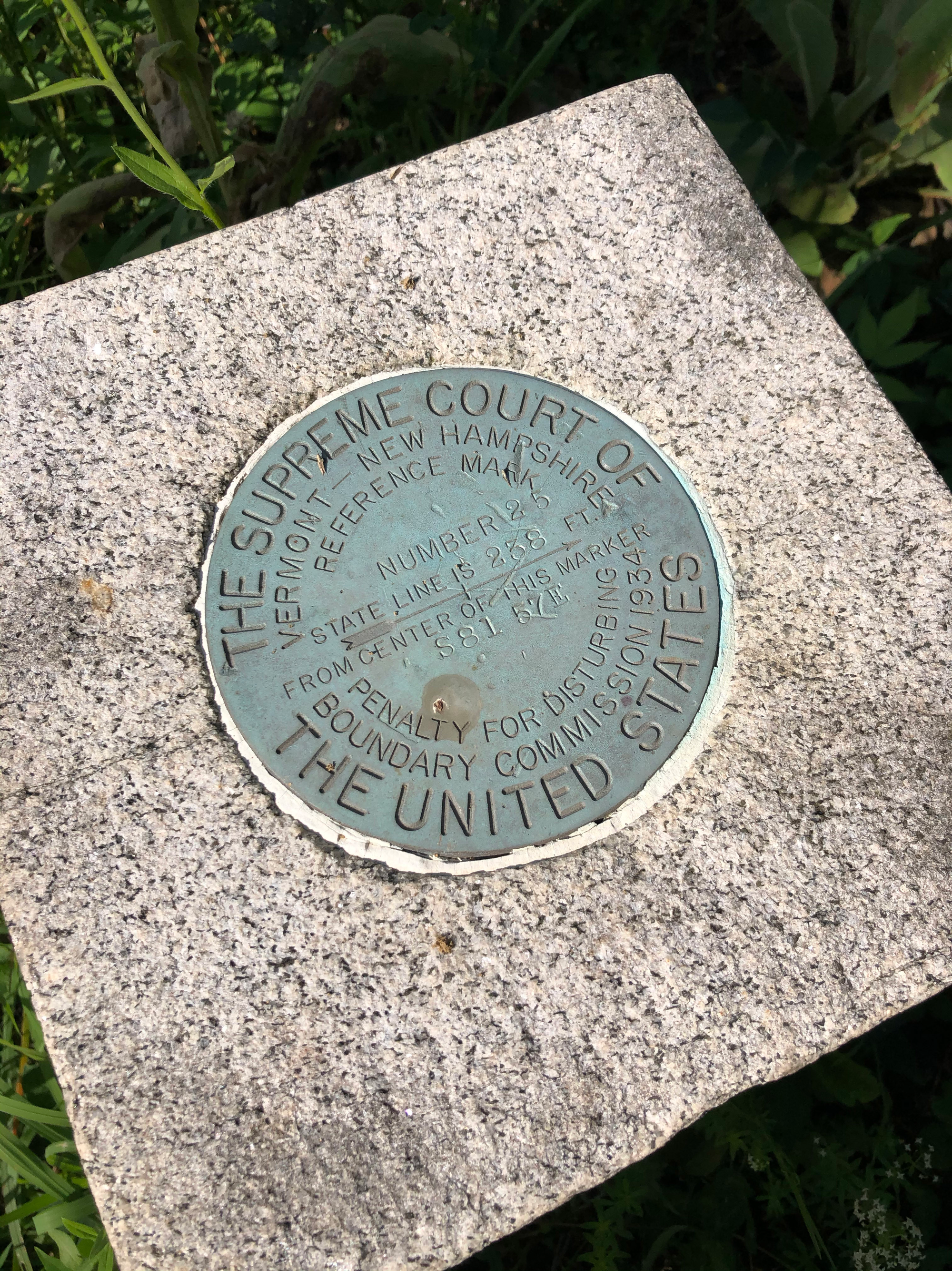
This culminated in 1933 with Vermont v New Hampshire, a US Supreme Court case that held the border was the "west bank at the mean low-water mark" and ordered a detailed survey of the border to eliminate further petty sibling squabbling. The survey in 1934 created a series of stone survey markers defining the border. Since, almost by definition, that border is underwater much of the time, the actual survey markers are all located west of the border. Here's a picture of one such marker, located in Wilder, VT's Kilowatt Park. Note that it says the real state line isn't this marker, but a point 238' east of the marker:
And, like pairs of NH towns, the State boundary is also required to be periodically perambulated:
The treaty is like RSA 51, in that meetings are required every 7 years. They aren't required to visit the markers, but usually have a brief ceremony where the Governors or Attorneys General meet on one of the bridges, exchange handshakes, and usually agree to accept existing survey data. This last happened in 2023.
Suggested Reading
- Daniel Himmelstein's Blog Entry on Perambulation and his efforts to locate the Hanover, Canaan, Enfield, Lebanon quad-point, and why it wasn't located where he thought it would be.
- Kurt Gotthardt’s 2010 report titled A History of Enfield Town Lines: From 1761 to 2007.
- A Look Back: Land surveying practices have evolved with time. Valley News, April 6, 2026. By Steve Taylor, former Perambulator for Plainfield, NH.
- Austin Longpré's History of Corbin Park
- Some Devoted New Englanders Went for a Stroll in 1651 and Haven't Stopped Since. Wall Street Journal, May 23, 2015, detailing the Hillsborough-Dunbarton and Albany-Madison Perambulations in 2005.
- A Manual on Municipal Boundaries: Perambulating Town Lines in New Hampshire
- On the hunt for boundary markers Alison Colby-Campbell Merrimack Valley Life (2025-07-01)